Friday 30 June 2017

Day 25 Vaja to Nyirbator

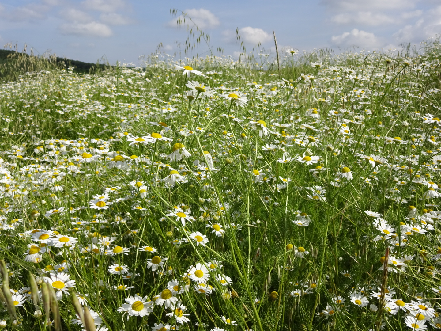
It was more road walking and sandy tracks today across a landscape not flat but with hills of very low relief, not especially memorable.
I passed through a few villages enjoying an apple filled croissant by a fountain in the park of Kantorjanosi. There does seem to be an effort to make these villages attractive, with groups of men cutting grass and sweeping pavements and the edge of roads. It did appear to have an element of a "make work" scheme but the results were pleasing and people were keeping the road frontage of their houses neat, raking the sand or with white flowered aloes. Maybe there was a "best kept village" competition. I also noticed that many people rode bicycles around the villages I had been walking through, to go to the shops or bars (bicycles outside a bar were a sure sign it was open), I suppose as it's flat and the roads tend to be quiet. In the UK, despite the short distances, people would take their cars rather than cycle, causing parking problems outside the local shops. The effect of greater wealth or laziness? I particularly enjoyed seeing girls and ladies riding side saddle on the luggage rack at the back of bicycles while their boyfriends or husbands peddled them about, it seemed conduct suitable of a gentleman, even if frowned upon in these more safety conscious and feminist days.
Although a short day to make up for some long days recently, I still felt tired as I approached my destination of Nyirbator. The final part of the Kektura into Nyirbator takes you on a circuitous route around the various sights of this modestly sized town. These included some big churches, a museum and a lake with a dragon sculpture and benches.
As I approached my hotel (Hotel Palma) I was a bit worried by the youths lounging outside, until I realised they were waiting for a bus, the stop being beside the hotel. My apartment is very plush in yellow and grey with plenty of room for me to do my exercises, so no excuses!

A road section approaching Kantorjanosi

Inside of one of the churches in Nyirbator

Thursday 29 June 2017

Day 24 Kisvarda to Vaja

I walked along roads and sandy tracks lined with trees today, much of it in the rain.
As I left Kisvarda the route was again beside a busy road, but this time walking on a cycle path. Later the route diverted onto a quieter road through the village of Anarcs, followed by the village of Gyulahaza. The highlight of Gyulahaza is a MiG 21 rising out of a rose garden. Apparently a memorial to the first Hungarian astronaut,  Bertalan Farkas, who was born in the village, although the bust next to the jet plane is of Yuri Gagarin.
Then it was a walk along sandy tracks between locust trees to the village of Rohod to the sound of thunder rumbling as the skies darkened. Curiously, I saw little lightening, and the thunder seemed mixed with the more regular thumps of artillery practice. As black clouds gathered I thought it wise to eat the lunch I had bought this morning. Inevitably on starting a piece of pizza bread heavy rain began to fall. It continued to fall at a fluctuating intensity for the next few hours and I was glad of a comprehensive set of waterproofs (jacket, trousers and rucksack cover) as the temperature dropped and I started sliding on saturated sand.
Eventually the rain cleared and I reached the vicinity of the Osto Vendeghaz (where I booked to stay) at 4:00 pm, an hour before I had told the owner. I called him and said I would be in a nearby "Bufe", basically a small bar. Here I managed to get a beer and even better a free Palinka.  The men seated in the bar were curious about what I was doing (few British people reach this area), so when the helpful Vendeghaz owner arrived, who spoke some English, I answered various questions he translated - where was I from, how far did I walk each day and how heavy was my rucksack (quite heavy as I was carrying the means to make an evening meal)?
The Vendeghaz is a sort of little holiday home by a lake with reeds and ducks, a bit untidy and neglected. As a "welcome drink" the owner had given me another glass of Palinka. Although the taste is different its effects reminded me of an occasion when I had too many vodka toasts in Russia. Some time after you have drunk it, you start to feel not quite in control. Consequently after cooking a sort of cassoulet from a tin supplemented with bread and tomatoes, I bedded down for an early night.

Mig21 in village of Gyulahaza

Sandy tracks through trees

Lake at bottom of my Vendeghaz

Wednesday 28 June 2017

Day 23 from a field before Cigand to Kisvarda

My night was not as peaceful as I expected as someone was riding a motorcycle up and down the farm tracks late into the evening. There were also sounds of a tractor doing something, thankfully not cutting the grass in the field I was camping in.
Today had some beautiful sections. After struggling through some overgrown and clearly rarely used sections I reached one of the straight drainage ditches that are presumably responsible for changing the landscape from a swamp into large areas of farmland. These drains, the straight tracks beside then, the big fields of wheat with no hedges and the occasional copses reminded me of the Fens and the area south of Wisbech where I have two cousins. One difference was a flock of sheep cropping the grass on the banks of one of the drains and looking fat and healthy on it. They were escorted by a shepherd and his two dogs of indeterminate breeding. The dogs raced up to me barking aggressively, I stood my ground turning to avoid them getting behind me, various sources had indicated that such sheepdogs can be very protective. The shepherd shouted commands at the dogs, waved his stick and walked towards me. After the usual exchange in which I explained I was a stupid English person who did not speak Hungarian I checked (with hand gestures) that it was OK to pass through his flock so as to continue on my route. He said "Egen" (yes) so I slowly moved through his flock trying not to disperse the sheep, then moved steadily away while the dogs mounted a rearguard fit of barking. Shortly after I disturbed a deer which ran off and then stopped and turned around as if to check what I was, then it trotted off on its way.
After Cigand (and a stop to buy my breakfast of Pepsi and a slice of what might have been meant to be Pizza) the path followed the northern embankment of the Tisza river. The river was invisible behind trees until I later crossed it. This is one of Hungary's great rivers. I hope to be joining it again when I enter Serbia on a later part of my walk, with I expect a similar landscape. The land had been almost perfectly flat but south of the Tisza the soil turned sandy and there were low hills, ancient sand dunes maybe. Crops were being irrigated as I passed. For the final section of the day the path followed a drain lined with willow, poplar and elder. It reminded me of a picture by Constable. My presence disturbed ducks which flew into the air catching the wind above the trees. I also disturbed herons and group of storks.
The conurbation of Varos and Kisvarda is a reasonable sized town with a ruined castle, pedestrianised area and a rather nice coffee and cake shop. I am now at the Parish Bull hotel, where the decor may be a bit "over the top" for many people's taste, but where I have nevertheless enjoyed beer and dinner.

Bridge over the Tisza

Tisza river

Path beside a drainage canal before Kisvarda

Day 22 Satoraljaujhely to between Pacin and Cigand

Not such a great night as people were talking in loud voices in a room nearby until after midnight. Today however was my first day on the Alfoldi Kektura or Great Plains Blue route. As expected there were not any hills to climb for a change.
After breakfast it was into town to stock up at the Coop, then out of town following the familiar blue and white waymarks. Sadly the first half of the day was walking beside a busy road with heavy lorries passing. I do not remember such a long stretch of busy road on the E4 since southern Spain. There were two distractions on this lengthy section, firstly police, their car hidden among trees, pulling cars over, secondly, some kind of archaeological park with lots of carved posts and other markers. There were a few signs which appeared to describe what was found at this site, it appeared to date from Arpad times when the Hungarians first invaded the area. It was hot with limited shade so I stopped at the first "bufe" I saw and had a sort of non-alcoholic lemon shandy - very refreshing as it was not too sweet. I tried the same at the next Bufe I saw but accidentally got the alcoholic version, but only 1.5%.
After the long road section there was a welcome detour on farm tracks to the south of the main road, then another detour through a muddy, mosquito infested area to the north, which took the path right to the Slovak border. The path heads south after the village of Pacin. After following very straight farm roads the Kektura turned into a highly overgrown section besides some woods. As it was 6:00 pm I decided to stop and camp on an area of flattened grass in the field next to the woods, maybe used as a campsite before. As the grass was a few feet high I thought it unlikely that anyone would see me and my tent, so settled down to what I hoped would be a quiet evening.

Busy road out of Satoraljeujhely

View back towards Satoraljeujhely and some of the mountains that I crossed on the Blue route 

General comments on Blue route (Kektura) east of Budapest

In reviewing the Blue route from Budapest the first and most obvious thing to say is that there are a lot of trees, invariably beech, oak or locust trees, but with willows in wetter areas. Coniferous trees were rare. Trees are very nice but they do spoil the views, fortunately there are several look out towers (kilato) on the  route so you can see magnificent panoramas over the top of the trees. There are also several ruined castles. Where significant parts are still standing they have excellent views over the surrounding countryside, all the better to detect signs of an attacking force.
Secondly, there is a lot of climbing, more than I expected. The hills may not be that high, but the total ascents each day can be similar to those when I walked across Switzerland,  Bavaria and Austria on the E4 long distance footpath.
Thirdly, in June there were lots of mosquitoes and other insects which left me with lots of itchy bites. They made evenings wild camping an unpleasant experience. Together with the heat it made walking in March (when I walked the western part of the Blue route) a much more pleasant option.
Fourthly, in June the profusion of flowers of many colours in the meadows and alongside tracks were a delight with butterflies and bees (acceptable insects) sampling their nectar. I occasionally sighted deer and wild boar. I saw a woodpecker close up for the first time and storks in the latter part of the walk, many other birds sang to me from first light at 4:30 a.m. to last light at around 10:00 p.m..
Fifthly, the paths were well marked with blue and white waymarks on trees and posts and various signs. Paths were only occasionally overgrown with no sections of busy road and only rare muddy sections. Accommodation was more difficult to find compared with when I walked the western half of the Blue route, perhaps because after Visegrad the path goes through smaller places, villages rather than towns. In consequence I did quite a bit of wild camping. There were Vendeghaz that I could have used. These are usually self contained rooms in a building with the owner living somewhere else, so you can't simply drop by and ask for a room. Hungarians would simply ring up to book, but if you cannot speak Hungarian you have two options. One is to use Booking.com or Revngo.com, a Hungarian booking site in English. Unfortunately, many Vendeghaz are not on these sites and even using Revngo.com you are often asked to contact the owner after making a reservation to arrange at time of arrival. You can deduce other Vendeghaz exist from sites such as www.kektura-szallasok.hu or gotohungary.com/accommodation. The other option is email, you can use Google translate to produce a Hungarian version of a request for a reservation. However the exchange of emails takes time and advance planning, which reduces flexibility.
Finally, for someone from the UK, walking the route is a chance to enjoy all things Hungarian. Food has been an interest since my early childhood. In Hungary I enjoyed cold fruit soups, the little dumplings, fresh water fish like carp, outlaw soup not to forget the more famous goulash. In the shops, restaurants and little bars, everyone was friendly and helpful despite my language difficulties.

Monday 26 June 2017

Day 21 Makkoshotyka to Satoraljaujhely

I woke to the gentle rhythm of light rain, which fell intermittently all morning before reaching downpour strength for the last 2 hours of my walk. In a period of no rain I had removed my waterproof trousers, trying to look as stylish as some passing hikers. A mistake as my hiking trousers soon became saturated by the wet vegetation and stayed that way once heavier rain forced me to put my waterproofs back on.
My final day on the original Blue route (or more accurately the Országos Kéktúra) was similar to many others, walking through deciduous trees, down the main street of a village of single storey houses, up and down hills with some wicked climbs near the end. The ascents and descents were particularly treacherous as the rain had turned the surface of the path into greasy mud, making my progress slow, nervous and wobbly.
Around 1:30 pm I reached Satoraljaujhely, having left the main Kektura 45 minutes beforehand. At Satoraljaujhely I start on the Alfoldi Kektura, or the Great Plains Blue route. The Alfoldi Blue route was created much later and despite signs outside, the local tourist office appeared unaware of it, or maybe I did not make myself clear when I asked if they had any information on it or accommodation on route.
I have settled into the Berg Panzio and eaten a meal in town on the main, tree lined pedestrianised street, watching the girls and boys sitting on benches on opposite sides of the street (to my mind the lads had the sharpest haircuts, some barber around here is handy with the clippers). My guidebook was a bit dismissive of Satoraljaujhely, a border town next to Slovakia, but it has a sort of faded grandeur, with occasional buildings decorated with classical motifs and missing rendering.
I am now sat in the bar of the Panzio have a "Grouse" whisky to celebrate the end of one Kektura and the start of another.

A final walk through woods on the Kektura

The pleasant pedestrianised centre of Satoraljauhely

Day 20 Arka to a hill between Regec and Makkoshotyka

Today it was back to climbing through beech and oak, although the gradient of the climbs was generally not excessive as the path often followed valleys, gradually gaining height. The stream in the main valley consisted of a chain of stagnant pools (ideal for mosquitoes) in a stony riverbed. The local rock appeared to be volcanic.
Today's highlight was Regec castle (Regec Var in Hungarian). It involved a steep climb off the main path but as I missed Boldogkovaralja castle yesterday I was determined to visit this one. In addition to the ruined walls and astounding views (made more astounding as you usually see very few views through all the trees), there was an interesting set of posters (with English translations) describing the development of firearms as well as what the Chief Stewart did. Even better the castle had a Bufe where I could get a coffee without which I imagine I am prone to headaches caused by caffeine withdrawal.
A little further in the village of Regec I was so pleased to find another Bufe open I had a second coffee, an orange juice (good for you) and an ice cream (well I needed the calories as my trousers are getting very loose) which I enjoyed while watching a cartoon on TV with English subtitles.
Then it was more climbing surrounded by trees, passed two abandoned Turistahaz's. I stopped early as yesterday had been a long one. To minimise mosquito attacks I am camped in a fire break on top of a hill. I checked there were no insects before settling down for tea on a fallen tree trunk. Now there are lots of ants around me, picking up crumbs of stale bread roll and walking around with them in an apparently random fashion, possibly for my amusement as I finished with an apple.

A walk in the woods

Regec Castle

Day 19 Irota to Arka

Today the walk was mainly across farmland, past fields of wheat and barley, maize and sunflowers, the paths lined with camomile daisies and scattered with red poppies. There were a few patches of woodland, notable for their muddy tracks.
At the first village I stocked up with food, tomorrow being Sunday and many shops closing from midday Saturday. Unlike the usual "supermarket" style arrangement, this shop was more old fashioned with the goods behind the counter so you had to ask for them. Though I say it myself I did rather well asking for and pointing to what I needed, another few years walking around Hungary and shopping will be a doddle.
Through the next few villages and most of the rest of the day I found myself repeatedly approaching the same two girls from behind, quite unintentionally I must add. I would pass them as I walked a little faster, then I would miss a turn (the problem with farmland is there are no trees to paint waymarks on). In the meantime the girls would get ahead of me (paying more attention to the correct route) and I had to pass them again. Then I diverted to visit a Kilato, they did not and so passed me. I then caught up with them again. This happened a few more times as I stopped for a Coke or a rare coffee and cake. Embarrassing, as I am sure they must have thought I was deliberately following them, but I lacked the Hungarian to make light of the matter. The coffee and cake shop was a pleasant discovery as it was well hidden behind frosted glass so no one could see any surreptitious cake eating. I think the clue is looking for signs saying "Cukrászda" (cake shop).
I had hoped to find accommodation in the Encs area. There was plenty when I planned the trip but online they were all reporting "sold out". I called at two places and they confirmed this, in the second place in the village of Boldogkovaralja they were settling out tables for around 200 people so I presume some big event was on.
Not wanting to entirely miss out on the pleasures of fixed accommodation I had a meal at a local "Bufe" and then headed out beyond where the houses and cemetery ended in the nearby village of Arka, pitching my tent in a quiet corner of some forgotten field.

Walk over farmland, note the big fields

Flowers at the edge of a cornfield

So many lovely daisies

Day 18 Bodvaszilas to Irota

The first section of walk was across the flat bottom of the Bodva valley, much of it on an old railway line. House martins were out in force swooping after insects and each other, the morning fresh after some early rain. Cuckoos called to each other across the meadows as I passed strips of land planted with potatoes and wheat.
At one point the path crossed a river on the remains of a railway bridge, you had to walk across (the admittedly rather wide) remaining girders. On the far side of the valley I came to the abandoned industrial complex the railway once served, with furnaces (?), offices and other remains left as they were to decay. Among these remains was a hut marked "Ticket Office, Information", but what were these tickets for? I could find no explanatory signs. Shortly after I walked through the village of Bodvarako, where a cheery villager pointed out a stork in a nest on top of a telegraph pole with a baby stork (a storklet?).
But the inevitable climb could no longer be delayed and I sweated profusely while climbing up the next hill through woodland. A brief reward was seeing a herd of small wild boar run off, but not very clearly as my glasses were somewhat misted by hot sweat. After an otherwise monotonous walk through trees I descended into the village of Tornabarakony. The remainder of the walk included some meadows with ox eye daisies, and farmland that allowed more open views. Skylarks sang on high. Irota was the last village I passed through, then climbing up yet another hillside I found an open spot near the path to pitch my tent, which had fewer mosquitoes than sites in the woods.

Kektura cross a river on this abandoned railway bridge

Abandoned industrial buildings

Thursday 22 June 2017

Day 17 Josvafo to Bodvaszilas

The first part of the walk took me passed an old Jewish cemetery at Josvafo,  I have come across a few such cemeteries on the E4 since Vienna, all lacking any post war gravestones, a vestige of a Jewish community that no longer seems to exist.
Then it was up a valley passed a barred cave entrance and into a series of meadows. These had a beautiful array of flowers, predominantly white and purple today with yarrow, clover, knapweed and many exotic varieties I could not identify. The assemblage changed as I walked, with showy plantains and patches of startlingly pink flowers. Some management must have been involved to stop the bushes growing but it was a great contrast to the high intensity farming practised in other European nations. I later met some Forest Rangers, one of whom spoke English. He pointed out that as we were in a National Park they had a duty to preserve the variety of flowers as well as the birds and wildlife. The Rangers asked how I found the Hungarian people. A difficult question to answer as with my lack of Hungarian, social intercourse was difficult, especially as I am not by nature a conversationalist. In consequence I inevitably miss a lot of things.
After many trees and passing a few sinkholes in the limestone countryside (plus a surprising number of springs) I reached my destination of Bodvaszilas where I had reserved an apartment at Diofa Vendeghaz. My lack of Hungarian again came to the for as I struggled to understand what the owner's mother was telling me (it was that the shop closed at 5:00 p.m. so I had better get a move on if I wanted to buy anything for tea!). All settled I was left with a place far too good for the price I was charged, with fresh cut flowers and a welcome shot of Palinka was included!

I thought this might be a plantain

Wednesday 21 June 2017

Day 16 Zadorfalva to Josvafo

I woke at 5:30 am to the sound of massed mosquitoes buzzing around my tent (no doubt singing "I smell the blood of an Englishman"). I killed several while doing my toilet and packing up but more mosquitoes accumulated. The first few hours of the walk through trees was not pleasant: long, loose trousers protected my legs and DEET insect repellent helped my bare arms but they were penetrating my thin tee shirt. I did not like to overdo the DEET as it dissolves plastics and synthetics like my rucksack etc..
Some of this wooded section was along the Slovak - Hungarian border, marked by concrete posts. Always exciting thinking of slipping from one country to another without anyone knowing.
Finally, it was out into the open away from the blood sucking insects and the path down to the Aggtelek caves. After a morning coffee and a hamburger from the nice couple in the "bufe" by the car park I went on a tour of the caves as they were recommended by "German Tourist", a famous blogger. The tourist office kindly looked after my rucksack as I did so. The caves were good with some nice, broccoli shaped stalagmites, and I liked the music they played in the "concert hall" cave, although some coloured lights and laser beams would have helped the light show. I also should have brought a jacket as it was rather cool...
Then it was up onto the limestone hills with a viewpoint and a 6 km walk to Josvafo. I could hear thunder as I walked along, getting closer and closer, but fortunately reached the Tengerszem hotel before the rain began. With the rain falling I was left with no alternative but to have a late and leisurely lunch as I watch the world go by from the hotel restaurant. Later I discovered the hotel is next door to more caves you can visit, but one cave visit in a day was enough for me so after a walk around the village I settled for an evening beer.

Slovak border

Broccoli shaped stalagmites (the guide probably called them something more fanciful but as he was talking in Hungarian I will stick with vegetable analogies)

Cave was quite big

Day 15 Uppony to Zadorfalva

The village shop opened at 6:30 am so I was able to pop in for some breakfast materials and food for the rest of the day. After kefir (like yoghurt) and a chocolate croissant (not as nice as it sounds) I was on my way up the first hill, through the inevitable woods but reaching a decent view point just off the path. Then it was down hill again to a flat road section by a defunct railway (with warning lights still flashing on a level crossing) into Putnok. Managed to find a slice of cake but no coffee shop. Then it was up and over the next wooded hill, diverting to what was signposted as a castle ruins (with an L shaped symbol). There was a mound and some earthworks covered in trees but that was it...
The path then dropped into Kelemer  (a coke and ice cream opportunity) then a road section to the village of Gomorszolos. This village had a number of traditional looking houses with thatched roofs and carved wooden columns and fretwork along the verandas.  Like Kelemer and other villages it had a museum. I did not venture in as previous experience of village museums suggested that without a knowledge of Hungarian it was not going to be enlightening. Then a change of scenery as I climbed through meadows, disturbing butterflies and insects of many colours among the long grass and wild flowers, stumbling into ruts hidden by the vegetation. The absence of trees gave a greater sense of the landscape, in that I could actually see it.
In the final village of the day, Zadorfalva,  a young boy tagged on to me, despite my saying I was English and did not speak Hungarian, which usually puts people off (my appalling pronunciation is probably enough). He persisted and I ultimately realised that he wanted to take me to the stamping point. You can get booklets for the Blue route which you can stamp with a rubber stamp unique to the village or location. Quite a fun thing to do but not something I was doing ("Nem Pressio" seemed to be what I had to say). This really perplexed and disappointed the boy when he eventually gave up after following me around the village.
Finally it was up into the woods to find a spot to camp. I picked a spot on a summit in the hope that the breeze would blow away the insects, but it does not appear to have worked. ...

Meadows with flowers

A butterfly on my rucksack

Monday 19 June 2017

Day 14 Bankut to Uppony

Uncharacteristically I overslept, but as the planned walk was a short 18 kms, downhill or on the flat it did not matter too much just this once.
The day fell into three parts, firstly a walk down through the trees out of the Bukk mountains. The beech trees were remarkably tall, in places they had fallen down across the path bringing adjacent trees with them. A bit of clambering over tree trunks was then required to follow the path.
The second part began at the village of Malinka, the Kektura followed the road through this village and the next. There were many bars and shops along the way and as it was hot a Coke and Cornetto were warranted. Then the third part was beside a lake with fishermen, picnicers and sunbathers enjoying the waterside. The lake ended at a gorge where the road took you through into the village of Uppony where I am staying the night at the Oreg Somfa Vendeghaz. On greeting the hosts I was given a welcome drink of Palinka. You down it in one it seems. It seems quite strong but you don't realise that until later....after the third shot.

Lake before Uppony

Sunday 18 June 2017

Day 13 Szarvasko to Bankut

Rain was falling on my tent waking me at 4:30 a.m.. My tent, a Nordisk Telemark, has many fine points (such as weighing under a kilogram and with pegs that don't bend) but it does tend to collect rainwater in a pool on the flysheet above my feet, which drips into the tent if you touch it from inside (and sometimes if you don't). Consequently I was very careful not to disturb any such pool until I got up. By 5:30 I decided I might as well get an early start as I had over 30 km to walk and a well over 1000m ascent.
I  climbed up into the Bukk hills through intermittent showers passing a chapel with some sheltered seats where I had some breakfast. Snails were enjoying the wetness and I had to be careful to avoid stepping on some large examples. The rain had also turned the remaining autumn leaves a rich russet, contrasting with the new bright green leaves. Walking down towards Belapatfalva I passed an old Cistercian abbey and for a 500 forint ticket the two men on site let me in to have a look at the plain but spiritual interior. At Belapatfalva the Coop was open (although it was Sunday) so I picked up some snacks for lunch, sipped coffee at the bar nearby and visited a cash machine to top up on money, delivered in very high denominational notes that no-one wants.
I was worried by the long, steep climb after Belapatfalva as my right hip had started to be painful when I walked with my rucksack on. Making matters worse I took a wrong fork and walked for a kilometre uphill on the wrong path, forcing me to retrace my steps. Instead of concentrating on the "blue lines" which mark the route I had been thinking about the pre-World War 1 map of Hungary on the wall of the bar I was in earlier, at the time Hungary was much larger. I had been reading a book set in Hungary at the end of the 19th century. The main protagonists were aristocrats living in Transylvania, then part of Hungary. I guess there is some nostalgia in Hungary for that time when it was much larger, although I guess the Romanians are happier with the way things are now, as they formed the major ethnic group in Transylvania.
As I approached my destination of Bankut the number of people grew, the sun having come out and it being a Sunday. Bankut appears to be just two buildings among the trees. I checked into one, the Feher Sas Panzio where the lady in charge made great efforts to speak in English.  After a very hot soup and dish of meat and dumplings I went for a walk to the local look out tower. There was a lovely view to the west with the red sun setting over the distant hills but I admit I was a bit worried about climbing down the ladder that lead to the top platform what with the wind and being alone, so I did not stay long...

Cistercian abbey by Belapatfalva

Russet remains of last Autumn's leaves

Saturday 17 June 2017

Day 12 Sirok to Szarvasko

A large and group of young people were at the campsite last night, talking and enjoying themselves until after midnight. Although they kept me awake I consoled myself that they would be late getting up and I would have the toilet block to myself in the morning. I was wrong! At 6:30 am the block was full of steam as fit young men showered. While they had a breakfast arranged at the campsite I walked down to the local Coop to buy mine, conveniently open from 6:30 and complete with coffee machine (with unpleasant tasting coffee).
On heading off my first stop was the castle ruins overlooking the campsite. Closed at the time I arrived but with some great views. There were some interesting shaped rocks nearby which added to the scenic interest. The walk today was mainly through oak forest with some beech and what I identified as locust trees. I had seen quite a few on my walk through Hungary and camped under some last night but it took some time to confirm their identity using Google (they look a bit like Mimosa and as they were not in flower...).
A red fox crossed into my path,  paused to look at me (while I tried to stay still pretending to be tree), and then headed off, unconvinced by my tree impression. This happened twice, the most foxes I have seen in a day since walking through London on the Thames path (Britain has a lot of urban foxes).
Arriving at Szarvasko around 1:00 pm I spotted a coffee trailer and had a lovely Turkish coffee with a bit of orange in. Hugely better than the coffee I bought from a machine this morning. Then it was to another campsite, Oko park, which like yesterday's site is underneath a Castle ruin. I climbed up to the castle but there was very little left of it, but good views from the rock.

Sirok Castle

Day 11 Matrahaza to Sirok

I climbed up a ski run to Mt Kekes from where I stayed in Matrahaza in only 40 minutes. As this is the highest point in Hungary I thought the rest of the day would be easy walking downhill. I was wrong!
The top of Mt Kekes was an anticlimax. I was expecting great views, and while there were some, mainly I saw a hotel (closed), a TV tower and building, two cafes (thankfully one open so I could get a morning coffee), various memorials  (one to dead motocross riders complete with photos, ribbons and a helmet) and various stalls of which two were open. From one of them I bought some very overpriced fudge. I should have realised there were no signs giving prices, always a sign that something's expensive.
As this was the highest point on my trip I tried a "selfie" but decided I looked too ugly, maybe it was the sun tan lotion giving me a corpse like complexion, or maybe the red nose, the result of lack of said lotion. Maybe I had lost weight on the walk making my face more furrowed, many of the signs point out how many calories you will use walking the Kektura and its equivalent in hamburger units.
After the summit of Mt Kekes the path followed a ridge but with many steep uphill and downhill sections to reach individual peaks. I agreed with a pair of German hikers that there was a lot more climbing on the Kektura than we expected.
As a reward for the hard work there were a lot better views than on some of the earlier days as the ground often dropped away steeply. The flowers were also a delight: whites, yellows and deep pink. Some looked like Michaelmas Daisies, others yellow foxgloves, most I could not identify.
Finally completed the last long descent into Sirok where I am camping on a proper campsite for a change, with beer and showers. May have been wiser to book a chalet as a thunderstorm started soon after I pitched my tent. Fortunately I was in the Var Etterem enjoying a healthy meal (salad to get some vitamins) and a glass of red while the rain fell.
Finally a shower, where they had me fooled for a while by sneakily delivering cold water from the tap with the red spot on, reversing standard global practice.

More views from the path today

I really liked the flowers

Thursday 15 June 2017

Day 10 Matraverebely to Matrahaza

Rose to another fine day with blue skies and walked downhill through the town of Matraverebely, some meadows of tall grass followed, a prequel to the first climb of the day. The lengthy ascent took me to the Agasvar Turistahaz (closed as it was not a weekend) and then up and down along the ridge to the village of Matraszentistivan. Here I stopped for coffee finding a place open(!) and stayed for an early lunch as my right knee was needing a rest.
Then it was more uphill to Galyateto where I climbed the kilato  (200 forints but not in 20's, I had to get the right change at a shop). There was a magnificent panorama from the top, I could see the flat lands of the Hungarian plain to the south and flattish lands to the north. In between I could see the hills that the Blue route follows, including the hills coming up next. This section of the path has some good views even at ground level as the land falls away steeply.
After dropping down there was a final uphill struggle to reach an area called Matrahaza. When I was planning the trip there appeared several places to stay but they were either closed (Pagoda Panzio) or full. However a very kind and English speaking lady at the etterem (meaning restaurant) and panzio (meaning pension as in the sense of lodgings) by the bus stop found me a room in a nearby international sports facility while I drank a very refreshing glass of beer (nothing like a long walk on a hot day to make the first few mouthfuls of a cold beer taste wonderful). I had dinner among ladies from Turkey's judo team, some powerful looking Serbians and various other athletic looking types. Clearly state run I had to sign 8 pieces of paper to get a room while the patient lady at reception typed in extensive details.
Meadows of long grass after Matraverebely

Kilato at Galyateto well worth 200 fts for the climb

Day 9 Holloko to Matraverebely

An unremarkable day but a pleasant one. 
I started with coffee and a poppy seed Danish at the café then loaded up with supplies for the day at the shop (including insect repellent after my last camping experience). Initially, I made good progress down a broad valley which made me too early for the recommended bean soup at Bableves Csarda. Then the big climb of the day up to a kilato (lookout tower). Some men were there and told me something in Hungarian. Not understanding I smiled and carried on. Then I realised it was to warn me that they were painting the picnic benches, tables and wooden steps and platforms of the kilato. Fortunately I had not sat down on the bench but only went half way up the kilato in case the damp preservative was dissolving my boots!
Continuing along a ridge through trees I disturbed a deer in the path which bounded off into the bushes. Not quite as impressive as yesterday when I startled a wild boar piglet in a muddy section of track. My passage often seems to result in things crashing through the undergrowth, but I rarely see the animal responsible. At the end of the ridge there were a few dead looking villages in the following valleys, one of which had a nice exposure of ancient lava flows and pyroclastic deposits, although I found the signs (which had an English translation) rather confusing.
Inevitably there was an uphill section at the end of the day, partly along a pipeline route. The path led to Saint Laszlo's pilgrimage site. A grand affair with an outdoor auditorium, mosaics, a basilica, lots of confessional cabins, a holy spring in a gorge and a coffee shop (closed). After a bit more climbing I found a place to camp, this time in the open where trees had been felled, with a view and a gentle breeze to keep away the mosquitoes. This time orange, spotted butterflies took an interest in my rucksack and tent, while some large ants tried to eat my tea and bits of me.

Typical path through the woods

Outdoor altar at St Laszlo's pilgrimage site

Camp site

Tuesday 13 June 2017

Day 8 Cserhatsurany to Holloko

As I was packing up my tent a mosquito finally got me, putting me in a poor mood to start the day. However I soon brightened up as I walked through the trees in dappled sunlight. Throughout the morning I walked up and down through woodland except for one village and a few fields. I missed a ruin marked on the signboards but it was hard to miss the main attraction of the day, the castle and museum village of Holloko.
The castle was set on a hill, with excellent visibility to spot marauding invaders. Today the only invaders were crowds of children in various groups, filling in their worksheets while noisily running around. Approaching the castle there were some information boards with an English translation and I spent a little time trying to distinguish Turkey and Sessile Oak (the bark is the clue). I checked into Kemences Vendeghaz in time for lunch. I took the recommended local dish - pork with mushrooms, pate and peas, with a tomato salad for a bit of vitamin C.
In the afternoon I walked around the village which has a number of small museums. As signs were in Hungarian I arbitrarily went into two of them. The first had Paloc in its title which is the name of the local people, so I expected some kind of folk history. It turned out to be a museum of dolls dressed in traditional costumes. The next museum I tried was a printing museum. I was even given the chance to print something myself on a Gutenberg type press! The curator did very well demonstrating the various printing presses given he had no English and I had no Hungarian.
I am now drinking coffee (no cakes) listening to Boy George playing in the background.

Hollokoi Var (Holloko Castle)

Holloko museum village

Day 7 Romhany to Cserhatsurany

Tired, I slept very soundly until woken by bells calling the faithful to Mass at 5:00 am. Fortunately I soon fell back to sleep waking in time to visit the local Coop at 7:00 to get some breakfast which I ate on the patio outside my room.
The first ascent of the day was delayed by a walk along tarmac to the next village, then as yesterday it was through woods, passed fields of corn and meadows of hay, uphill then downhill for the rest of the day. My interest was raised by several notices pinned to trees advertising coffee, cake and ice cream. I am very partial to coffee and cake so looked forward to arriving at the establishment. Needless to say I was disappointed,  it was only open at weekends. A later signpost at another village also disappointed me, the Kavehaz (coffee house) was closed Mondays, cruel. I had to make do with a Coke and Cornetto from the convenience store.
Deep purple and blue flowers at the edge of cornfields and meadows were a feature of today's walk. Also iridescent blue-green beetles. Two of these I found upside down, helplessly waving their legs in the air. Thinking of my wife, who is always kind to animals, I did what she would have done and gently turned them over with a leaf. They looked shocked!
This appears a less frequented part of the Kektura with fewer waymarks, picnic benches and people. It was certainly hot. In the woods after the village of Cserhatsurany where I planned to camp, there were lots of gnats and aggressive mosquitoes wanting blood from my sweaty body. I quickly put up my tent and zipped myself in spending the rest of the evening in hiding.

A cornflower, one of the many beautiful flowers

Sunday 11 June 2017

Day 6 Szendehely to Romhany

At 4:30 a.m. I was woken by the usual, rather loud dawn chorus and also some loud barking or yelping. I could not see the animal causing it and went back to sleep until it was time to break camp around six.
I had booked tonight's accommodation and the owner wanted to know when I would arrive. Always difficult as it depends on when you wake up, how many hills there are and whether you find some interesting sight on the way. As no sights of interest were in my plans I calculated 3:00 pm based on the slower than usual speed I was achieving (due to more climbing than I expected ). This meant I had to be at the three villages on route at certain times and I spent my day trying to keep on schedule.
So I was delayed by my first unplanned sight, a kilato (lookout tower) a steep climb up from where I camped. This was a socialist era design in naked concrete with ladders inside instead of stairs. However the view was magnificent.
Woods of beech and oak followed along with fields of hay with meadow flowers. As it was Sunday most things were closed although an open restaurant at the penultimate village almost made me delay my arrival. I stuck to plan however stopping for a coke and ice cream on the outskirts of Romhany before being spotted by mein host, walking the final stretch to the room at Rozsakert Vendeghaz I had booked. Smelly after two nights camping and sweaty from the heat, the shower was truly enjoyable as was the meal (sour cherry soup and chicken with prunes) and cold beer at the nearby restaurant. They made the hot walk all the more worthwhile, can we have really, intense enjoyment without some hardship first?

A view from the Kilato in the direction I was heading

Day 5 Nagy-Hideg-Hegy to Szendehely

A long day, my progress seemed slow but it was enlivened by some pleasant sights.
After a few short, steep climbs I reached the first of those sights, a kilato (lookout tower) which gave enormous views (after climbing the 133 numbered steps). One might be tempted to short cut this bit of the Kektura that adds a lengthy loop to the North of the Danube bend, but the National park it takes you through seemed very beautiful as I looked down upon it, a bird of prey circling below me.
After a lengthy walk through the woods I reached Nograd. At the edge of the village was a spring. A concrete affair with a plaque where the spring was directed into a stainless steel piece of pipe. The spring must have been a good one as a number of people were waiting to use it, one family with a dozen or so plastic bottles. I filled all my bottles as I expected to camp again tonight, a significant weight to carry as I headed off to climb a small but steep sided hill to the local ruined castle. All these castle ruins fly a Hungarian flag, illustrating a sense of national pride in past achievements.
Doubling back on itself several times the onward path took me through more woods up more hills, with one good viewpoint. The beech and oak trees are green and beautiful but do tend to hide the distant panoramas. There were many people out walking, probably because it was the weekend. There were some light showers and I felt conspicuous as the only one putting waterproofs on.
Reaching the village of Szendehely I noticed people gathering at the crossroads by the church. Curious I joined them. Shortly there came a small group of musicians, playing accordion and tambourine, leading a wedding procession. There was the bride (in white), the groom and what I assumed were bridesmaids in lilac accompanied by their beaus.  In the crowd of villagers cake and refreshments were being passed around and I was fortunate to be offered a plastic cup of dry cider and two (very welcome) slices of cake.

Wedding at Szendehely

Thus fortified I continued on my way, which left the village on a cycle track and then climbed a mountain. After a suspension bridge, a couple on benches by a fire followed by what seemed an excessive climb I reached a flat area by some sinkholes, one (according to the sign) leading to an extensive underground cave network. Tired and resolving not to wander around to much at night, I set up camp and spent the night disturbed only by someone riding his motorcycle up the hill.

Suspension bridge across a ravine

Day 4 Visegrad to Nagy-Hideg-Hegy

Today I crossed the Danube on the ferry and climbed many ascents through woodland to reach the high point of Nagy-Hideg-Hegy.
It was a slow start to the day as the 9:45 a.m. ferry was the first I could catch. An enjoyable crossing with views back to the Citadel looking down on the river. The combination of walking and a boat across the Danube made me think of travels made by iron age men, although their boat would not have been pushed across the river by a tug with a moustache painted on its bow.
Nagymaros on the opposite bank seemed a pleasant place. The ferryman had the shoo the waiting, smiling children off the landing ramp. I stopped at a supermarket to buy some extra water (as I planned to wild camp that evening) and some apples. I chose Granny Smiths (not my favourite) as they could withstand being knocked about in my rucksack without bruising. This caused the lady at the checkout to burst into a stream of Hungarian and she was forced by my incomprehension to find an English speaking colleague. It seemed that the Granny Smiths were an extortionate price and I needed to be warned (about 60 pence each). Not knowing the correct price of apples and considering the queue behind me I assured her that was fine (me being a stupid Englishman).
There followed a long ascent up the mountainside, the first of several, to a kilato  (lookout tower) where you could see both sides of the large incised meander of the Danube, an impressive sight.
Lunch at Kospallag was a coke and a large bag of crisps (small bags no longer seem to be available). Fortified I continued up to Nagy-Hideg-Hegy (which means "big cold mountain") where there was a Turistahaz signposted offering food, drink and a bed. Sadly, I have had little success with these establishments to date. Either they have been abandoned, or they are closed with a telephone number on the door which I dare not ring with my non existent Hungarian. In my most successful case a lady directed me to a nearby panzio  (pension). The first two Turistahaz's I passed today were overrun with children running around and noisily enjoying themselves. While beer was advertised the bars appeared to be closed.
The final Turistahaz on the top of Nagy-Hideg-Hegy was after a long climb, with many false summits so I was tired and sweaty when I  reached the place hoping for at least a beer. Things looked promising, the doors were open and a sign indicated that the bar was open but nobody was around.  I rang the bell beside the bar and waited. As nothing happened I rang it again for longer. This resulted in loud pop music being turned on. I waited some more, while reading the posters (apparently I was intersecting the Jacobsweg). Despite the loud music no one turned up and after shouting a few hellos through the kitchen hatch I gave up and went to look at the view from the mountain top.
A kilometre or so away I camped among the trees and had some food at a nearby viewpoint with a large section of Hungary and Slovakia in front of me.

Panoramic view of the two sides of the Danube Bend

Typical footpath through the woods

Thursday 8 June 2017

Day 3 Pilisszentkereszt to Visegrad

Today was one of the better days on the Blue route if rather tiring. There was pleasant walking in woodland and across meadows of long grass with ox eye daisies and many other flowers that I was unable to name. Then at the end of the walk was the historic town of Visegrad with its ruined citadel, tower and palace.
The owner of the Panzio were I stayed last night agreed to an early breakfast of 7:30 which meant I had climbed my first ascent by 9:00 a.m. when it was cooler. Dobogoko was the first village I reached which had a great lookout to the north across the wooded hills I later traversed with the Danube curving in the distance.
The second village was Pilisszentlaszlo where I bought my lunch at a shop and ate it outside. A Magnum ice cream, an energy drink called "Hell" and a banana (because I like to be healthy).
Reaching Visegrad after a long wooded section along a ridge I first visited the Citadel. It's a steep climb up from the town so I viewed it on the way, although that meant carrying my rucksack around, which is at its heaviest at the end of the day. The view across the Danube Bend is great from the ruins. After a steep descent I checked into the Hotel Var and headed off for the Palace ruins. By now it was 4:45 pm and as it closed at 5:00 pm the ticket lady sternly told me I had only 10 minutes. To compensate I paid the rate for a 62 year old, although the cheeky woman implied I could have passed for 70 and an even lower rate! Although maybe I misunderstood...

Danube Bend at Visegrad

Day 2 Budapest to Pilisszentkereszt

Reaching the point where I ended my walk in March, in the suburb of Szepvolgy took a bit of effort. First I had to walk from the Airport Hotel to the local shopping centre.  There I caught a commuter bus to the end of the Metro. Several stops on the M3 line and 2 stops on the M2 line followed (busy but fortunately not as bad as London's underground in the rush hour). Then I caught the HEV train followed by the number 65 bus. The latter caused a little difficulty as I tried to get on a waiting 65 bus rather than waiting at the designated stand.
Finally I was walking uphill through trees on the long distance walking trail called the Blue route, or Kektura in Hungarian, which I was to follow across the country.  Based on my planning today's hike would be 27 km long with a hefty 1000m of ascent. The Buda hills are not that high but the path takes you up three moderately step ascents, soon followed by three descents. At the top of the first ascent was a "kilato", an observation tower you can climb up to get a view, in this case looking back at Budapest.

View back to Budapest and the Danube from the Kektura

Much of the route, well marked by blue and white waymarks, was through woodland (nice for shade when the sun broke through the clouds) often on footpaths rather than the forest or farm tracks typical of much of the Blue route that I walked on my previous trip from Koszeg to Budapest. Compared with my last walk in March when the trees were bare, everything was very green with flowers and even wild strawberries and some cherries to follow my lunch with. Other notable sights included a hare, a memorial to a fallen soldier from 1945, stations of the cross, a chapel and holy spring in the forest, and a few groups of children, brown eyed and bare armed, walking or playing games, supervised by some adults. I recall such group trips to the country from my childhood with the boy scouts, but it is not something I see these days in the UK whether due to safety & insurance fears, lack of willing adults or because British children prefer their X boxes. The final section of the walk was through a Limestone gorge,  crossing and recrossing at small brook on wooden bridges. A pleasant way to end.
I spent the night in Pilisszentkereszt in the Kislugas panzio.  I went half board for a very reasonable price. The evening meal consisted of stew, something that resembled shredded dumplings, sauerkraut and pickled peppers. Very welcome after a hard day's walk although the dessert had been too long in the microwave and burnt my mouth. The other couple eating said some politeness on arriving and leaving but as I could not understand their Hungarian I just smiled. They must have thought me rude. 

Tuesday 6 June 2017

Day 1 Journey to Budapest

I got out of bed as quietly as possible at 5:00 am to avoid waking my wife. After dressing in another room and letting the dog out for a wee, I walked to the coach station. While I could have booked a taxi the hour's walk allowed some exercise in a day otherwise dedicated to sitting on buses and planes. The uncharacteristically empty streets and stationery swans, geese and ducks in the park (too early for them to chase young and old for stale bread) were another reward.
A long coach trip to Gatwick airport followed with the usual motorway delays. A book on my kindle by Hungarian author Antal Szerb gave some distraction. Then it was a wait at the airport while reading of the latest terrorist atrocity before the flight to Budapest.  Successfully negotiating the free shuttle from Budapest airport I reached the Airport hotel. A hotel more for business people and more expensive than I expect later accommodation to be, but handy for the airport.

Monday 5 June 2017

Blogging the E4 European Long distance Trail: Budapest to Cyprus

Inspired by a blog by John Hayes I have walked the E4 European Long Distance Trail from Tarifa in the south of Spain to Budapest. I have done things a little different from John. Instead of walking the route in one go, I have walked 5 weeks at a time, two or three times a year, leaving plenty of time to devote to my wife in my early retirement. My route has been a little different to John's, taking the southern route in Andalusia, staying on the GR7 from Spain to France through Andorra (it was just simpler as well as very beautiful in June) and walking via Vienna and the Neuseidlersee in Austria (a contrast to the classic alpine hikes of Austria). In addition I added a section from Cabo S.Vincente in Portugal to Tarifa a possible extension of the E4 to the South West corner of Europe. I also carry a lightweight tent and sleeping bag so I am not tied to accommodation (although I prefer a nice meal, shower and bed).

John stopped at Budapest, however the E4 continues through Hungary to Bulgaria, Greece, Crete and Cyprus. It was originally intended to cross Romania, but there is currently no identified route. However the Serbian Mountain Organisation have created a route for the E4 described in a booklet "Rambling through Serbia at a slow pace" that links Hungary and Bulgaria. This is the route I am intending to take.

As I found John's blog very useful in describing what lay ahead, I intend to complete a blog of my own for the rest of the route, which may assist or inspire or just put off future travellers.